blah blah blah
Middle Carter Mountain
Length: 10.2 miles out-and-backDifficulty (click for info): Very Hard
Elevation Gain: 3590 feet (+230 feet on return)
Rating (click for info): 9/10
Elevation: 4620'
Prominence: 712'
Driving Directions:
Trailhead and parking area are on Rt. 16 in Martin's Location, NH (summit is Bean's Purchase). Look for a hiking sign for Imp Trail in a small pull-off 5.4 miles south of Rt. 16's eastern junction with Rt. 2 in Gorham. Look for it just south of the entrance to the Dolly Copp Picnic Area, on the east side of the road. Click here for a Google map.
About the Hike:
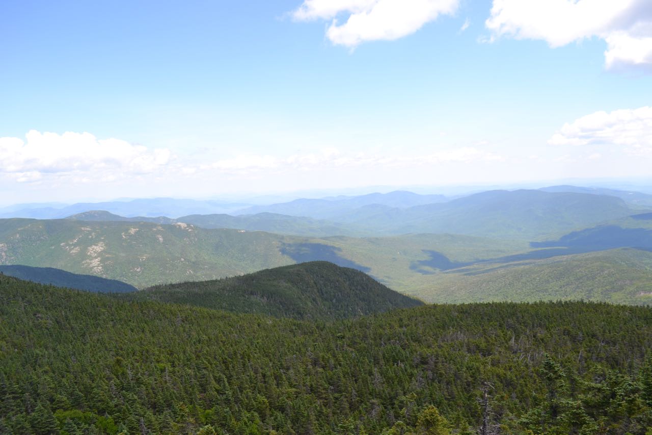
The highest of the summits which make up Carter Mountain, Middle Carter features great ledge views of Mt. Washington and the Northern Presidentials to the west as well as the Wild River Wilderness and the Baldface Range to the east. A short side trip to North Carter Mountain, included in the trip mileage, is worthwhile and provides hikers with an extra wilderness view. The hike is long and arduous, but halfway there you will cross the magnificent Imp Face, which has more views and a breathtaking drop. Atop the ridge, the scenic trail crosses much interesting terrain, including an alpine bog.
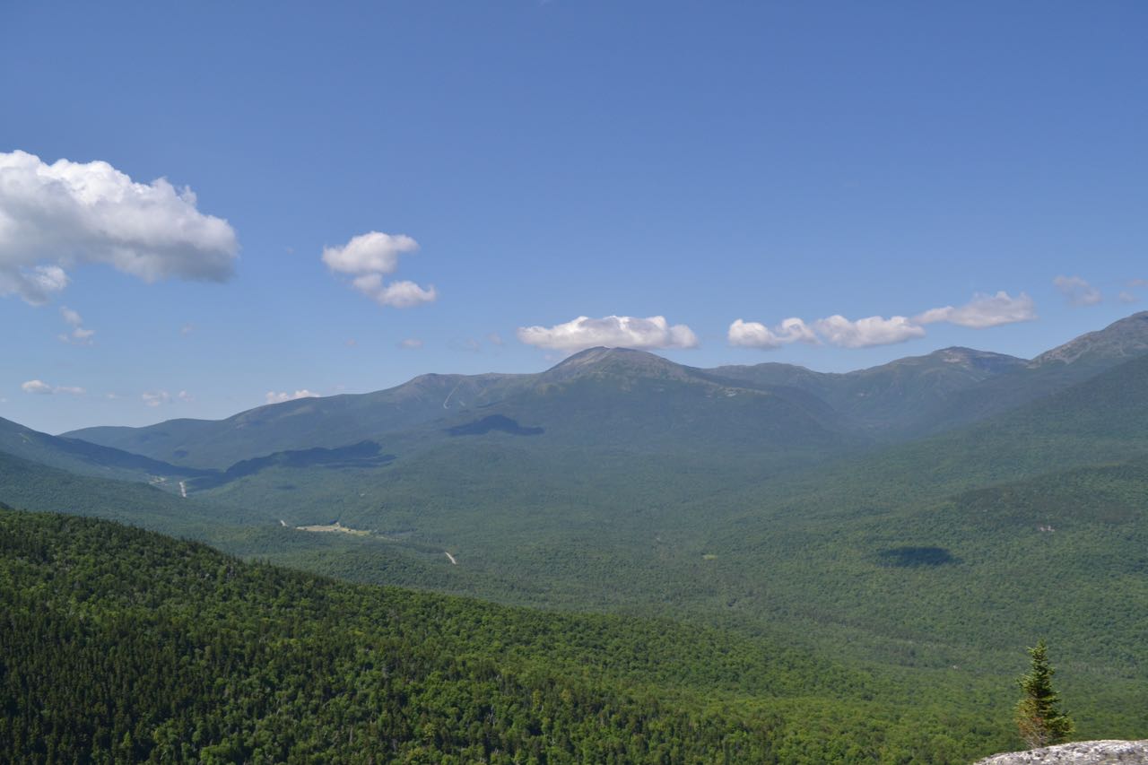
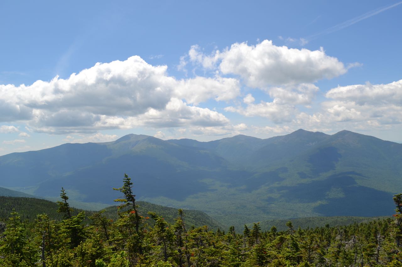
From the parking area, the Imp Trail climbs a staircase into the woods, passes a kiosk, then crosses a power line clearing. It ascends gradually through an open hemlock forest. Soon, Imp Brook is seen in a valley to the left. After a mostly easy walk of 0.8 miles, the trail passes a small cascade and crosses the brook. On the other side, it steepens for a 300-foot climb, then becomes flat, leading slightly downhill for a short distance. As the trail again becomes steeper, it heads toward the north side of a ridge, which it follows for most of the climb. One wooden ladder is encountered in this section. Climbing remains constant until one mile from the Imp Brook crossing, where the trail makes a sharp right turn and ascends over ledgier terrain. It soon switchbacks again and continues along the side of the ridge. As it nears the Imp Face, the trail turns right and runs flat for a short distance before scrambling out onto the open ledges, 0.4 miles from the sharp right turn. Walk to the far side of the cliff for the best view. Above you is the high ridge of the Carters. Below is the valley of Imp Brook, hundreds of feet straight down. Wildcat Mountain rises above a ridge of South Carter Mountain, with the ski trails on Wildcat D seen behind Little Wildcat Mountain. Wildcat's slopes descend to Pinkham Notch, where you can see Rt. 16. Through the notch, you can see Rocky Branch Ridge, which rises to Slide Peak. The ridge continues up to Boott Spur, then Mt. Washington. Next over are the four great Northern Presidential peaks: Mts. Clay, Jefferson, Adams, and Madison. Below them is the massive cutout of the Great Gulf. To the right of Madison, you can see the Crescent Range, with the Pliny and Pilot Ranges behind.
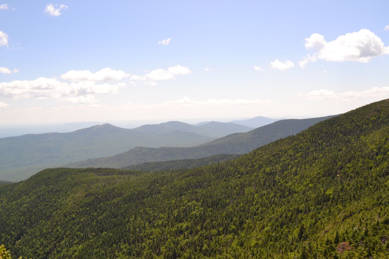
From the Imp Face, the trail makes a steep 70-foot descent, passing by the side of a small cliff. It then ascends at easy grades across the slope through a thick, dark forest, soon crossing a branch of Imp Brook, the first of five brooks and many more small seasonal streams. In just under a mile from the Imp Face, the trail crosses the last brook, another branch of Imp Brook, and descends to a trail junction. Imp Trail continues to the right; this can be used as a loop on the descent. It is easier, but 0.4 miles longer, including a 0.3-mile road walk. Turn left onto North Carter Trail and continue climbing gradually. The trail eventually steepens and after more than half a mile, narrows as it enters a forest of fir trees. At a left turn, the trail becomes wet for a short section. After a while, it becomes steeper and enters a more open forest. It levels off as it approaches the ridge, where it ends at the Carter-Moriah Trail 1.2 miles from the Imp Trail. For the side trip to North Carter, turn left. The trail descends briefly to a fern-filled col, then climbs easily to the viewpoint ledge in 0.2 miles. From here, there is a fine view into the Wild River Wilderness. To the far left is Shelburne Moriah Mountain, seen over Mt. Moriah's east ridge. To the right of Moriah's ridge is Maine's Caribou Mountain. Next over is the state line-straddling Royce Mountain, with Maine's Speckled Mountain behind. To the right is Mt. Meader, with the Meader Ridge leading up to the Baldfaces. Further over are Sable and Chandler Mountains, with Kearsarge North to the right and behind. Much closer is the round mass of Mt. Lethe, which you will walk over to get to Middle Carter. To the right of Mt. Lethe, some of the distant central White Mountains can be seen.
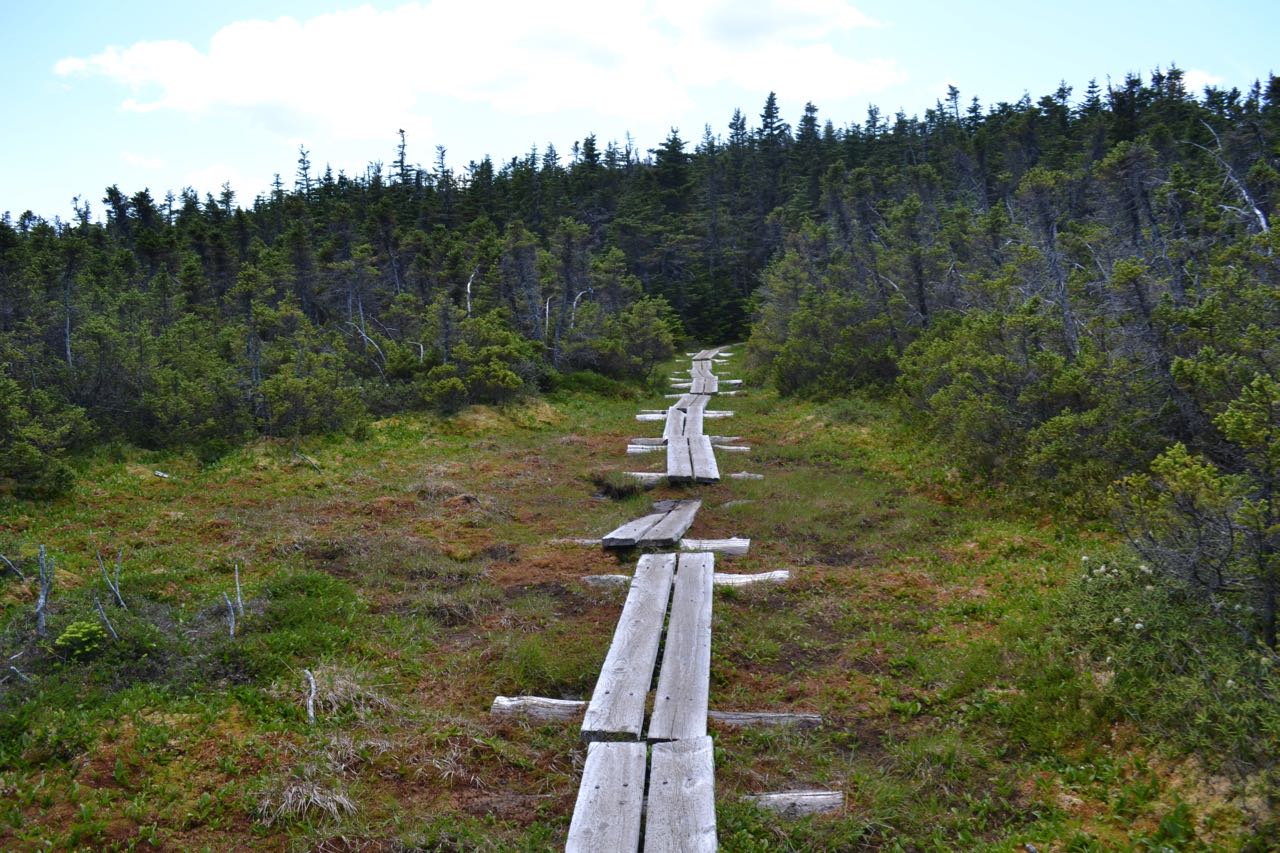
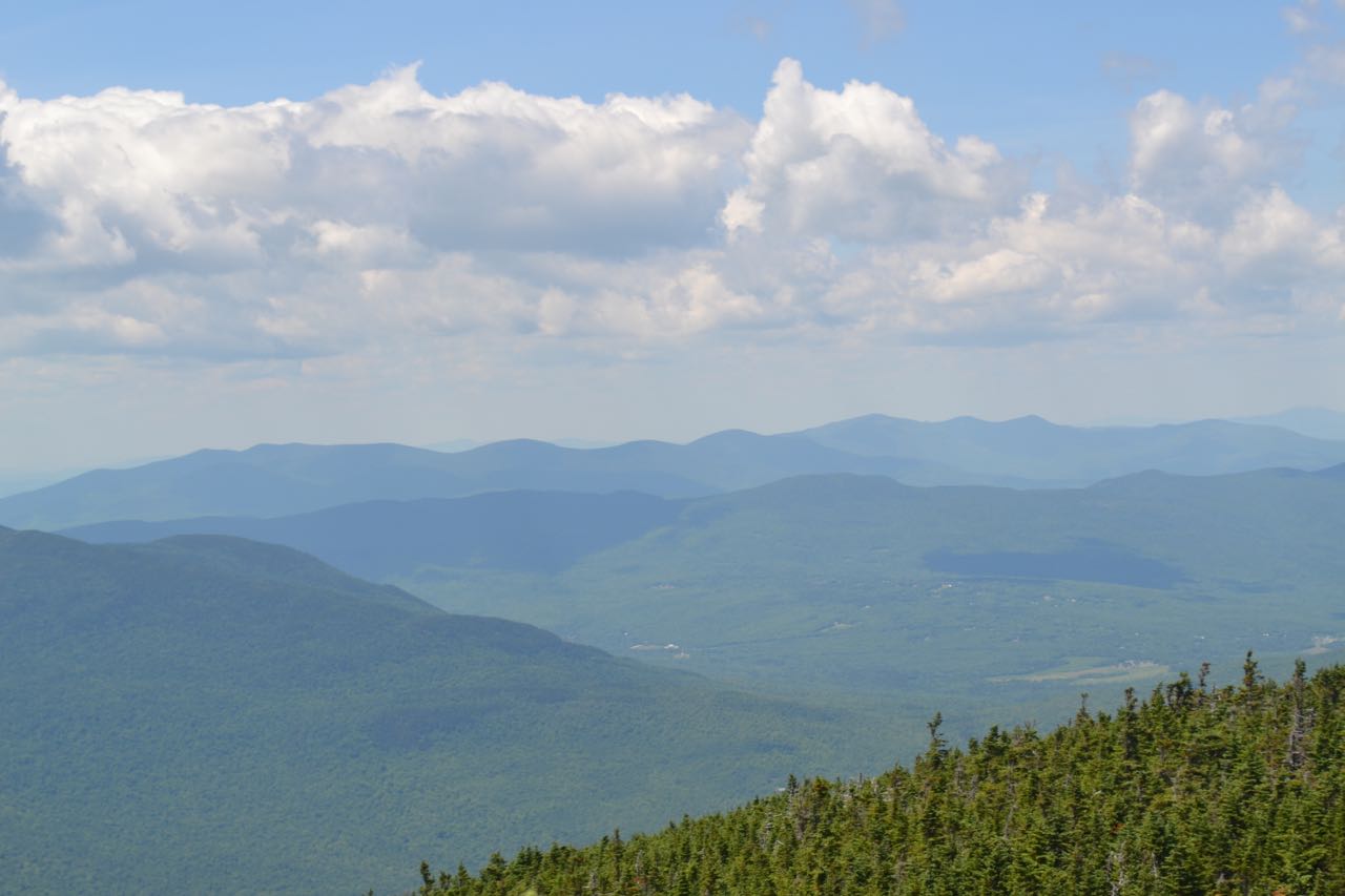
Return to the junction with North Carter Trail and continue straight on Carter-Moriah Trail (right from where you came up). The trail climbs over a small rocky knob, then drops into a wet area which is crossed on bog bridges. It continues climbing over rocky terrain over another bump and passes near the summit of Mt. Lethe, where there are slight views, after 0.2 miles. The trail then drops 100 feet off of Mt. Lethe and follows a boardwalk into an open bog. Next, it ascends to a flat open area after another quarter mile, where there are views over the trees. A small set of cliffs rises straight ahead. The trail swings around the cliffs to the right and climbs to the top of them, where views improve. The trail makes one last minor descent, then climbs to the open ledges just below the wooded summit of Middle Carter after another 0.1 miles. Here, there are great views in multiple directions. The view over the Wild River Wilderness is much the same as it was from North Carter, but now you can see the summit of Mt. Moriah and the Mahoosuc Range beyond. The center of the view is blocked by Mt. Lethe. To the west, the view is similar to the view from the Imp Face, but from much higher. The highpoint of the mountain is just a bit further up the trail.
Printable directions page